

Bus 76 in Birmingham links Solihull Town Centre and Queen Elizabeth Hospital. The route is 19.0 km long with 55 stops, and the official schedule from National Express West Midlands puts the full trip at about 61 minutes. On a weekday it runs 49 trips in one direction, and 27 on a weekend day.
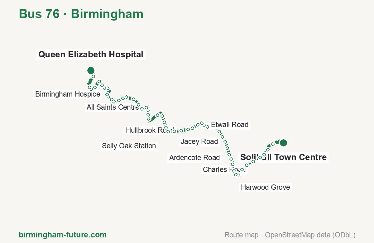
Route at a glance
| Mode | Bus |
|---|---|
| Route number | 76 |
| City | Birmingham |
| Operator | National Express West Midlands |
| Start → end | Solihull Town Centre → Queen Elizabeth Hospital |
| End → start | Queen Elizabeth Hospital → Solihull Town Centre |
| Route length | 19.0 km / 18.8 km in the opposite direction |
| Number of stops | 55 / 56 in the opposite direction |
| Travel time | about 61 minutes |
| Trips per day | 49 on weekdays, 27 on weekends one way (46 on weekdays → Solihull Town Centre) |
| Frequency | peak 15–20 · midday 20 · weekend 30–60 |
| First / last trip from «Solihull Town Centre» | 05:17 / 23:10 |
| First / last trip from «Queen Elizabeth Hospital» | 05:45 / 23:10 |
| Fare | 3.00 £ (fare in effect since 28 June 2026) |
| Updated | August 22, 2026 |
Route of Bus 76
Outbound: Solihull Town Centre → Queen Elizabeth Hospital
This direction has 55 stops and runs 19.0 km. The route passes Solihull Station, Saracens Head, Woodvale Mews, Fashoda Road. Below is the full list with the distance from the first stop.
| No. | Stop | From start | Note |
|---|---|---|---|
| 1 | Solihull Town Centre | 0.0 km | Terminus |
| 2 | Solihull Station | 1.0 km | |
| 3 | Solihull College | 1.4 km | |
| 4 | Alder Park Road | 1.8 km | |
| 5 | Dingle Lane | 2.1 km | |
| 6 | Charles Road | 2.5 km | |
| 7 | Widney Lane | 3.0 km | |
| 8 | Cranmore Road | 3.3 km | |
| 9 | Solihull Gate | 3.7 km | |
| 10 | Blackford Road | 3.9 km | |
| 11 | Harwood Grove | 4.1 km | |
| 12 | Bishopton Close | 4.5 km | |
| 13 | School Road | 4.9 km | |
| 14 | St James Church | 5.1 km | |
| 15 | Saracens Head | 5.5 km | |
| 16 | Jacey Road | 5.9 km | |
| 17 | Sandy Hill Road | 6.2 km | |
| 18 | Green Hill Way | 6.6 km | |
| 19 | Robin Hood Island | 6.8 km | |
| 20 | Newey Road | 7.3 km | |
| 21 | Etwall Road | 7.6 km | |
| 22 | Highfield Road Island | 7.7 km | |
| 23 | St Peters Church | 8.0 km | |
| 24 | Yardley Wood Station | 8.4 km | |
| 25 | Chinn Brook | 8.7 km | |
| 26 | Hullbrook Road | 9.1 km | |
| 27 | Hallstead Road | 9.5 km | |
| 28 | Woodvale Mews | 9.9 km | |
| 29 | Haunch Close | 10.2 km | |
| 30 | Hollybank Close | 10.5 km | |
| 31 | Ardencote Road | 10.9 km | |
| 32 | Hollie Lucas Road | 11.3 km | |
| 33 | Featherstone Road | 12.0 km | |
| 34 | Albert Road | 12.2 km | |
| 35 | Addison Road | 12.5 km | |
| 36 | All Saints Centre | 12.8 km | |
| 37 | Kings Heath Park | 13.1 km | |
| 38 | Station Road | 13.4 km | |
| 39 | Shutlock Lane | 13.8 km | |
| 40 | Ashbrook Road | 14.2 km | |
| 41 | Fashoda Road | 14.5 km | |
| 42 | Pershore Road | 14.7 km | |
| 43 | Darris Road | 15.1 km | |
| 44 | Park Corner | 15.3 km | |
| 45 | Woodside Road | 15.5 km | |
| 46 | Birmingham Hospice | 15.7 km | |
| 47 | Bournbrook Manor | 16.1 km | |
| 48 | Selly Hill Road | 16.3 km | |
| 49 | Tiverton Academy | 16.6 km | |
| 50 | North Road | 16.9 km | |
| 51 | Selly Oak Station | 17.3 km | |
| 52 | Battery Retail Park | 17.7 km | |
| 53 | Gibbins Road | 17.8 km | |
| 54 | The Oleaster | 18.5 km | |
| 55 | Queen Elizabeth Hospital | 19.0 km | Terminus |
Inbound: Queen Elizabeth Hospital → Solihull Town Centre
This direction has 56 stops and runs 18.8 km. The route passes The Oleaster, Milner Road, Haunch Close, Jacey Road. Below is the full list with the distance from the first stop.
| No. | Stop | From start | Note |
|---|---|---|---|
| 1 | Queen Elizabeth Hospital | 0.0 km | Terminus |
| 2 | The Oleaster | 0.4 km | |
| 3 | Gibbins Road | 1.2 km | |
| 4 | Battery Retail Park | 1.4 km | |
| 5 | Selly Oak Station | 1.7 km | |
| 6 | Hubert Road | 2.0 km | |
| 7 | Grange Road | 2.1 km | |
| 8 | Exeter Road | 2.5 km | |
| 9 | Rookery Road | 2.8 km | |
| 10 | Elmdon Road | 3.0 km | |
| 11 | Birmingham Hospice | 3.2 km | |
| 12 | Woodside Road | 3.5 km | |
| 13 | Park Corner | 3.6 km | |
| 14 | Darris Road | 4.0 km | |
| 15 | Milner Road | 4.2 km | |
| 16 | Fashoda Road | 4.6 km | |
| 17 | Ashbrook Road | 4.8 km | |
| 18 | Shutlock Lane | 5.2 km | |
| 19 | Station Road | 5.6 km | |
| 20 | Kings Heath Park | 5.9 km | |
| 21 | All Saints Centre | 6.2 km | |
| 22 | Addison Road | 6.4 km | |
| 23 | Albert Road | 6.8 km | |
| 24 | Featherstone Road | 7.0 km | |
| 25 | Hollie Lucas Road | 7.7 km | |
| 26 | Ardencote Road | 8.1 km | |
| 27 | Hollybank Close | 8.5 km | |
| 28 | Haunch Close | 8.8 km | |
| 29 | Woodvale Mews | 9.2 km | |
| 30 | Hallstead Road | 9.5 km | |
| 31 | Hullbrook Road | 9.9 km | |
| 32 | Chinn Brook | 10.4 km | |
| 33 | Yardley Wood Station | 10.8 km | |
| 34 | St Peters Church | 11.0 km | |
| 35 | Highfield Road Island | 11.3 km | |
| 36 | Etwall Road | 11.5 km | |
| 37 | Newey Road | 11.7 km | |
| 38 | Robin Hood Island | 12.3 km | |
| 39 | Green Hill Way | 12.6 km | |
| 40 | Sandy Hill Road | 12.8 km | |
| 41 | Jacey Road | 13.3 km | |
| 42 | Saracens Head | 13.6 km | |
| 43 | Longmore Road | 13.8 km | |
| 44 | St James Church | 14.1 km | |
| 45 | Union Road | 14.4 km | |
| 46 | Bishopton Close | 14.6 km | |
| 47 | Harwood Grove | 15.0 km | |
| 48 | Solihull Gate | 15.4 km | |
| 49 | Cranmore Road | 15.8 km | |
| 50 | Widney Lane | 16.2 km | |
| 51 | Charles Road | 16.6 km | |
| 52 | Dingle Lane | 17.0 km | |
| 53 | Solihull College | 17.6 km | |
| 54 | Parklands | 17.9 km | |
| 55 | Solihull Station | 18.2 km | |
| 56 | Solihull Town Centre | 18.8 km | Terminus |
Schedule and frequency
According to the official schedule from National Express West Midlands, the route runs 49 trips in one direction on a weekday, and 27 on a weekend day.
| Direction | Weekdays | Weekends and holidays |
|---|---|---|
| From «Solihull Town Centre» | 05:17 — 23:10 | 06:05 — 23:10 |
| From «Queen Elizabeth Hospital» | 05:45 — 23:10 | 07:10 — 23:10 |
Frequency calculated from the departure table: in the morning peak buses run every 15–20 minutes, most often every 20; midday every 20 minutes; in the afternoon peak every 20–30; on weekends every 30–60 minutes.
Fare and payment
A single ride costs 3.00 £ — fare in effect since 28 June 2026. The same fare applies to National Express buses in Birmingham.
A single journey on a National Express bus costs £3.00 and is valid on one bus for one journey only — it gives no transfer. A multi-operator nBus day ticket costs £5.50 and works on every operator in the scheme.
Frequently asked questions
How much does a ride on bus 76 cost?
3.00 £ for a single ride — fare in effect since 28 June 2026.
When do the first and last trips run?
From Solihull Town Centre the first is at 05:17 and the last at 23:10. From Queen Elizabeth Hospital they are 05:45 and 23:10.
How long does the trip from Solihull Town Centre to Queen Elizabeth Hospital take?
About 61 minutes end to end — the median of full trips in the official schedule.
How many stops does the route have?
55 outbound and 56 inbound according to the official GTFS feed. The two lists do not match exactly.
Does bus 76 run on weekends?
Yes. On weekends and holidays there are 27 trips in one direction, running from Solihull Town Centre between 06:05 and 23:10.
Every route number with its termini, operating hours and travel time is collected in the Birmingham buses overview.
Data current as of August 22, 2026. Schedule and termini — National Express West Midlands. Fares — National Express West Midlands. Stop list, schedule and route geometry come from the official GTFS feed (Bus Open Data Service (BODS)).