

Bus 3 in Birmingham links West Bromwich Bus Station and Merry Hill Bus Station. The route is 16.7 km long with 60 stops, and the official schedule from National Express West Midlands puts the full trip at about 54 minutes. On a weekday it runs 78 trips in one direction, and 45 on a weekend day.
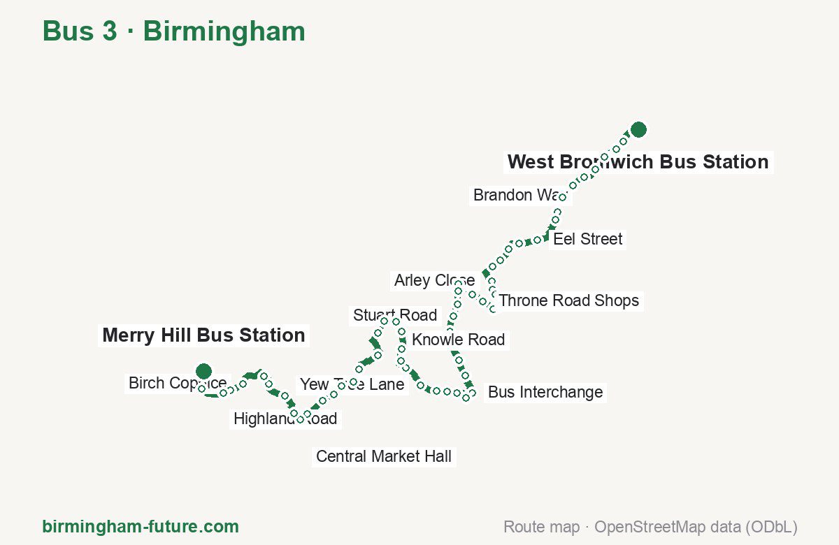
Route at a glance
| Mode | Bus |
|---|---|
| Route number | 3 |
| City | Birmingham |
| Operator | National Express West Midlands |
| Start → end | West Bromwich Bus Station → Merry Hill Bus Station |
| End → start | Merry Hill Bus Station → West Bromwich Bus Station |
| Route length | 16.7 km / 16.4 km in the opposite direction |
| Number of stops | 60 / 59 in the opposite direction |
| Travel time | about 54 minutes |
| Trips per day | 78 on weekdays, 45 on weekends one way |
| Frequency | peak 2–23 · midday 2–20 · weekend 5–45 |
| First / last trip from «West Bromwich Bus Station» | 05:15 / 23:50 |
| First / last trip from «Merry Hill Bus Station» | 04:47 / 23:20 |
| Fare | 3.00 £ (fare in effect since 28 June 2026) |
| Updated | August 22, 2026 |
Route of Bus 3
Outbound: West Bromwich Bus Station → Merry Hill Bus Station
This direction has 60 stops and runs 16.7 km. The route passes Bowater Street, Arley Close, Carlyle Road, Powke Lane. Below is the full list with the distance from the first stop.
| No. | Stop | From start | Note |
|---|---|---|---|
| 1 | West Bromwich Bus Station | 0.0 km | Terminus |
| 2 | Bowater Street | 0.5 km | |
| 3 | Cambridge Street | 0.7 km | |
| 4 | Margaret Street | 0.9 km | |
| 5 | Caroline Street | 1.2 km | |
| 6 | Brandon Way | 1.5 km | |
| 7 | Sandwell & Dudley Station | 1.8 km | |
| 8 | Century Road | 2.0 km | |
| 9 | Sandwell Council House | 2.3 km | |
| 10 | Oldbury Interchange | 2.5 km | |
| 11 | Eel Street | 3.0 km | |
| 12 | Alston Road | 3.4 km | |
| 13 | Oldbury Sports Centre | 3.6 km | |
| 14 | Wallace Road | 3.9 km | |
| 15 | Martley Road | 4.0 km | |
| 16 | Arley Close | 4.4 km | |
| 17 | Martley Road | 4.6 km | |
| 18 | Wolverley Crescent | 4.7 km | |
| 19 | Lovett Avenue | 5.0 km | |
| 20 | Shelsley Avenue | 5.1 km | |
| 21 | Throne Road Shops | 5.3 km | |
| 22 | Throne Close | 5.5 km | |
| 23 | Four Ways | 6.0 km | |
| 24 | Windsor Road | 6.2 km | |
| 25 | Charles Avenue | 6.4 km | |
| 26 | Stuart Road | 6.6 km | |
| 27 | Church Road | 6.9 km | |
| 28 | Church Road | 7.2 km | |
| 29 | Bell End | 7.5 km | |
| 30 | Carlyle Road | 7.8 km | |
| 31 | Bus Interchange | 8.1 km | |
| 32 | Sainsburys | 8.3 km | |
| 33 | Darby Street | 8.6 km | |
| 34 | Regis Road | 8.8 km | |
| 35 | Holly Road | 9.0 km | |
| 36 | Yew Tree Lane | 9.3 km | |
| 37 | Rowley Regis Cemetery | 9.7 km | |
| 38 | Garratts Lane | 9.9 km | |
| 39 | Fallowfield Road | 10.1 km | |
| 40 | Cornfield Road | 10.4 km | |
| 41 | Knowle Road | 10.6 km | |
| 42 | Knowle Road | 10.9 km | |
| 43 | Westley Works | 11.2 km | |
| 44 | Powke Lane | 11.7 km | |
| 45 | Cox’s Lane | 12.2 km | |
| 46 | Highland Road | 12.5 km | |
| 47 | Tinsley Avenue | 12.7 km | |
| 48 | Lawrence Lane | 12.9 km | |
| 49 | Spinners End Drive | 13.2 km | |
| 50 | Tesco | 13.5 km | |
| 51 | Central Market Hall | 13.7 km | |
| 52 | By Pass | 13.9 km | |
| 53 | New Village | 14.3 km | |
| 54 | Dalvine Road | 14.7 km | |
| 55 | Thompson Close | 14.9 km | |
| 56 | Birch Coppice | 15.4 km | |
| 57 | Coppice Rise | 15.7 km | |
| 58 | Victoria Road | 15.8 km | |
| 59 | Two Woods Lane | 16.2 km | |
| 60 | Merry Hill Bus Station | 16.7 km | Terminus |
Inbound: Merry Hill Bus Station → West Bromwich Bus Station
This direction has 59 stops and runs 16.4 km. The route passes Two Woods Lane, Ash Street, Carlyle Road, Martley Road. Below is the full list with the distance from the first stop.
| No. | Stop | From start | Note |
|---|---|---|---|
| 1 | Merry Hill Bus Station | 0.0 km | Terminus |
| 2 | Two Woods Lane | 0.3 km | |
| 3 | Victoria Road | 0.8 km | |
| 4 | Coppice Rise | 0.9 km | |
| 5 | Birch Coppice | 1.1 km | |
| 6 | Thompson Close | 1.7 km | |
| 7 | Dalvine Road | 1.9 km | |
| 8 | New Village | 2.3 km | |
| 9 | By Pass | 2.6 km | |
| 10 | Central Market Hall | 3.0 km | |
| 11 | Tesco | 3.1 km | |
| 12 | Spinners End Drive | 3.5 km | |
| 13 | Lawrence Lane | 3.7 km | |
| 14 | Tinsley Avenue | 3.9 km | |
| 15 | Highland Road | 4.1 km | |
| 16 | Ash Street | 4.3 km | |
| 17 | Cox’s Lane | 4.4 km | |
| 18 | Powke Lane | 4.8 km | |
| 19 | Westley Works | 5.2 km | |
| 20 | Knowle Road | 5.6 km | |
| 21 | Knowle Road | 5.9 km | |
| 22 | Cornfield Road | 6.1 km | |
| 23 | Fallowfield Road | 6.5 km | |
| 24 | Garratts Lane | 6.7 km | |
| 25 | Rowley Regis Cemetery | 6.9 km | |
| 26 | Yew Tree Lane | 7.3 km | |
| 27 | Holly Road | 7.6 km | |
| 28 | Regis Road | 7.8 km | |
| 29 | Oldbury Road | 8.4 km | |
| 30 | Carlyle Road | 8.6 km | |
| 31 | Bell End | 9.1 km | |
| 32 | Church Road | 9.5 km | |
| 33 | Stuart Road | 9.7 km | |
| 34 | Charles Avenue | 10.0 km | |
| 35 | Windsor Road | 10.1 km | |
| 36 | Four Ways | 10.5 km | |
| 37 | Four Ways | 10.7 km | |
| 38 | Throne Close | 10.9 km | |
| 39 | Throne Road Shops | 11.1 km | |
| 40 | Lovett Avenue | 11.4 km | |
| 41 | Wolverley Crescent | 11.6 km | |
| 42 | Martley Road | 11.8 km | |
| 43 | Arley Close | 12.0 km | |
| 44 | Martley Road | 12.3 km | |
| 45 | Wallace Road | 12.5 km | |
| 46 | Oldbury Sports Centre | 12.8 km | |
| 47 | Alston Road | 13.1 km | |
| 48 | Eel Street | 13.3 km | |
| 49 | Oldbury Interchange | 14.0 km | |
| 50 | Sandwell Council House | 14.2 km | |
| 51 | Century Road | 14.5 km | |
| 52 | Sandwell & Dudley Station | 14.7 km | |
| 53 | Brandon Way | 15.0 km | |
| 54 | Caroline Street | 15.3 km | |
| 55 | Margaret Street | 15.5 km | |
| 56 | Cambridge Street | 15.7 km | |
| 57 | Bowater Street | 15.9 km | |
| 58 | Victoria Street | 16.2 km | |
| 59 | West Bromwich Bus Station | 16.4 km | Terminus |
Schedule and frequency
According to the official schedule from National Express West Midlands, the route runs 78 trips in one direction on a weekday, and 45 on a weekend day.
| Direction | Weekdays | Weekends and holidays |
|---|---|---|
| From «West Bromwich Bus Station» | 05:15 — 23:50 | 08:00 — 23:45 |
| From «Merry Hill Bus Station» | 04:47 — 23:20 | 07:31 — 23:35 |
Frequency calculated from the departure table: in the morning peak buses run every 2–23 minutes, most often every 12; midday every 2–20 minutes; in the afternoon peak every 3–30; on weekends every 5–45 minutes.
Fare and payment
A single ride costs 3.00 £ — fare in effect since 28 June 2026. The same fare applies to National Express buses in Birmingham.
A single journey on a National Express bus costs £3.00 and is valid on one bus for one journey only — it gives no transfer. A multi-operator nBus day ticket costs £5.50 and works on every operator in the scheme.
Frequently asked questions
How much does a ride on bus 3 cost?
3.00 £ for a single ride — fare in effect since 28 June 2026.
When do the first and last trips run?
From West Bromwich Bus Station the first is at 05:15 and the last at 23:50. From Merry Hill Bus Station they are 04:47 and 23:20.
How long does the trip from West Bromwich Bus Station to Merry Hill Bus Station take?
About 54 minutes end to end — the median of full trips in the official schedule.
How many stops does the route have?
60 outbound and 59 inbound according to the official GTFS feed. The two lists do not match exactly.
Does bus 3 run on weekends?
Yes. On weekends and holidays there are 45 trips in one direction, running from West Bromwich Bus Station between 08:00 and 23:45.
Every route number with its termini, operating hours and travel time is collected in the Birmingham buses overview.
Data current as of August 22, 2026. Schedule and termini — National Express West Midlands. Fares — National Express West Midlands. Stop list, schedule and route geometry come from the official GTFS feed (Bus Open Data Service (BODS)).