

Bus 12 in Birmingham links Colmore Row and Coronation Gardens. The route is 20.1 km long with 64 stops, and the official schedule from National Express West Midlands puts the full trip at about 71 minutes. On a weekday it runs 49 trips in one direction, and 30 on a weekend day.
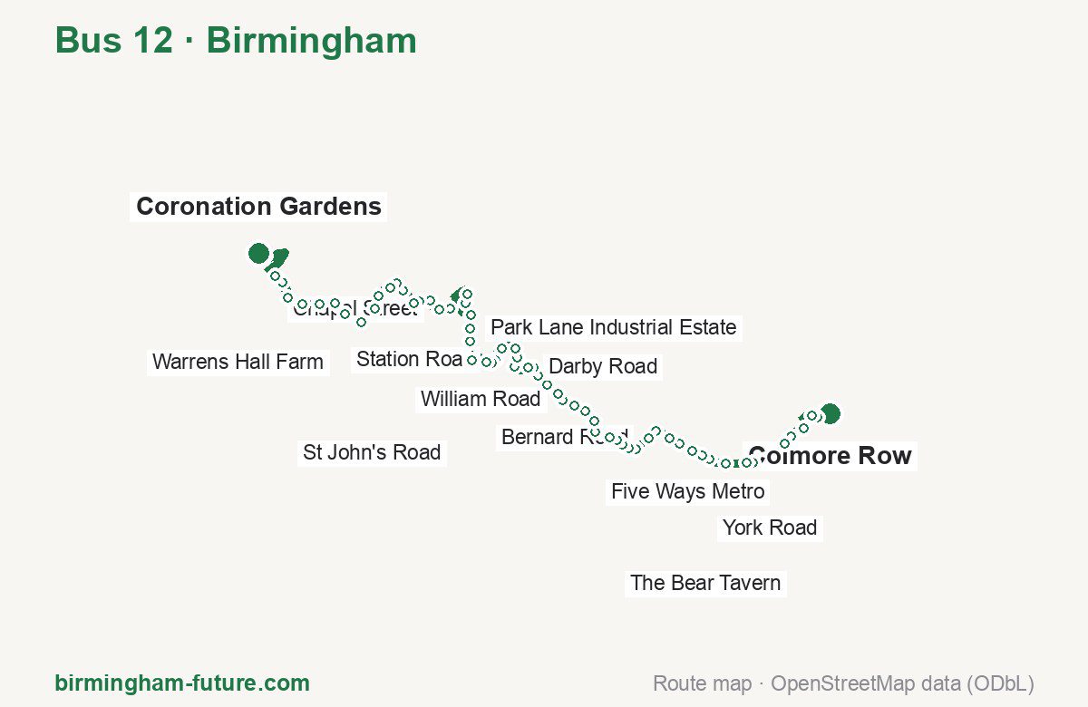
Route at a glance
| Mode | Bus |
|---|---|
| Route number | 12 |
| City | Birmingham |
| Operator | National Express West Midlands |
| Start → end | Colmore Row → Coronation Gardens |
| End → start | Coronation Gardens → Colmore Row |
| Route length | 20.1 km / 21.0 km in the opposite direction |
| Number of stops | 64 / 61 in the opposite direction |
| Travel time | about 71 minutes |
| Trips per day | 49 on weekdays, 30 on weekends one way |
| Frequency | peak 20 · midday 20 · weekend 28–60 |
| First / last trip from «Colmore Row» | 05:53 / 23:58 |
| First / last trip from «Coronation Gardens» | 05:16 / 23:09 |
| Fare | 3.00 £ (fare in effect since 28 June 2026) |
| Updated | August 22, 2026 |
Route of Bus 12
Outbound: Colmore Row → Coronation Gardens
This direction has 64 stops and runs 20.1 km. The route passes Art Gallery, Beverley House, Crosswells Road, Brades Road. Below is the full list with the distance from the first stop.
| No. | Stop | From start | Note |
|---|---|---|---|
| 1 | Colmore Row | 0.0 km | Terminus |
| 2 | Art Gallery | 0.3 km | |
| 3 | Newhall Street | 0.5 km | |
| 4 | Library Metro | 1.0 km | |
| 5 | Brindleyplace Metro | 1.4 km | |
| 6 | Five Ways Metro | 1.6 km | |
| 7 | Edgbaston Village Metro | 2.4 km | |
| 8 | Plough & Harrow Hotel | 2.6 km | |
| 9 | The Ivy Bush | 3.0 km | |
| 10 | Strathallen Hotel | 3.4 km | |
| 11 | York Road | 3.6 km | |
| 12 | Vernon Road | 3.8 km | |
| 13 | Deblen Drive | 4.1 km | |
| 14 | Stanmore Road | 4.4 km | |
| 15 | George Dixon Academy | 4.8 km | |
| 16 | Bernard Road | 5.0 km | |
| 17 | Beverley House | 5.3 km | |
| 18 | Barnsley Road | 5.5 km | |
| 19 | Drayton Road | 5.7 km | |
| 20 | Willow Avenue | 5.8 km | |
| 21 | The Bear Tavern | 6.0 km | |
| 22 | Ethel Road | 6.4 km | |
| 23 | Gladys Road | 6.7 km | |
| 24 | Addenbrooke Road | 7.0 km | |
| 25 | Thimblemill Cemetery | 7.2 km | |
| 26 | William Road | 7.5 km | |
| 27 | Hales Lane | 7.7 km | |
| 28 | Queens Road | 8.0 km | |
| 29 | Douglas Road | 8.3 km | |
| 30 | Basons Lane | 8.5 km | |
| 31 | Darby Road | 8.7 km | |
| 32 | Crosswells Road | 9.1 km | |
| 33 | Richmond Hill | 9.2 km | |
| 34 | Tat Bank Crossroads | 9.5 km | |
| 35 | Langley Green Station | 9.8 km | |
| 36 | Station Road | 10.2 km | |
| 37 | Mill Lane | 10.3 km | |
| 38 | Underhill Street | 10.4 km | |
| 39 | Titford Road | 10.8 km | |
| 40 | Park Street | 11.3 km | |
| 41 | Park Lane Industrial Estate | 11.6 km | |
| 42 | Oldbury Ringway | 11.9 km | |
| 43 | Oldbury Interchange | 12.4 km | |
| 44 | Sandwell Council House | 12.6 km | |
| 45 | Wharfside | 13.4 km | |
| 46 | Chapel Street | 13.6 km | |
| 47 | Brades Road | 14.0 km | |
| 48 | Bath Row | 14.2 km | |
| 49 | Bury Hill Road | 14.4 km | |
| 50 | Hilton Road | 14.8 km | |
| 51 | Lower City Road | 15.0 km | |
| 52 | Poplar Avenue | 15.2 km | |
| 53 | Poplar Rise | 15.6 km | |
| 54 | Hawfield Road | 15.8 km | |
| 55 | St Andrews Drive | 16.4 km | |
| 56 | Warrens Hall Farm | 16.7 km | |
| 57 | Gibbet Hill | 17.1 km | |
| 58 | Tansley Hill Avenue | 17.4 km | |
| 59 | View Drive | 17.8 km | |
| 60 | Blackacre Road | 18.2 km | |
| 61 | St John’s Road | 18.6 km | |
| 62 | North Street | 18.8 km | |
| 63 | Castle Hill | 20.0 km | |
| 64 | Coronation Gardens | 20.1 km | Terminus |
Inbound: Coronation Gardens → Colmore Row
This direction has 61 stops and runs 21.0 km. The route passes St Edmunds Church, Wolverhampton Road, Richmond Hill, Barnsley Road. Below is the full list with the distance from the first stop.
| No. | Stop | From start | Note |
|---|---|---|---|
| 1 | Coronation Gardens | 0.0 km | Terminus |
| 2 | St Edmunds Church | 0.5 km | |
| 3 | North Street | 2.0 km | |
| 4 | St John’s Road | 2.2 km | |
| 5 | Bennetts Hill | 2.7 km | |
| 6 | View Drive | 3.0 km | |
| 7 | Tansley Hill Avenue | 3.4 km | |
| 8 | Gibbet Hill | 3.7 km | |
| 9 | Warrens Hall Farm | 4.1 km | |
| 10 | Portway Hill | 4.6 km | |
| 11 | Hawfield Road | 4.9 km | |
| 12 | Poplar Rise | 5.4 km | |
| 13 | Poplar Avenue | 5.5 km | |
| 14 | Lower City Road | 5.8 km | |
| 15 | Hilton Road | 6.0 km | |
| 16 | Wolverhampton Road | 6.5 km | |
| 17 | no. 54 | 6.7 km | |
| 18 | Rounds Green School | 6.8 km | |
| 19 | Chapel Street | 7.1 km | |
| 20 | Wharfside | 7.3 km | |
| 21 | Sandwell Council House | 8.2 km | |
| 22 | Oldbury Interchange | 8.4 km | |
| 23 | Oldbury Ringway | 8.8 km | |
| 24 | Park Lane Industrial Estate | 9.1 km | |
| 25 | Park Street | 9.5 km | |
| 26 | Underhill Street | 9.9 km | |
| 27 | Mill Lane | 10.2 km | |
| 28 | Langley Green Station | 10.6 km | |
| 29 | Tat Bank Crossroads | 11.0 km | |
| 30 | Richmond Hill | 11.2 km | |
| 31 | Thornwood Close | 11.5 km | |
| 32 | Darby Road | 11.7 km | |
| 33 | Basons Lane | 11.9 km | |
| 34 | Douglas Road | 12.1 km | |
| 35 | Queens Road | 12.3 km | |
| 36 | Hales Lane | 12.7 km | |
| 37 | William Road | 12.9 km | |
| 38 | Thimblemill Cemetery | 13.1 km | |
| 39 | Addenbrooke Road | 13.4 km | |
| 40 | Gladys Road | 13.8 km | |
| 41 | Wigorn Road | 14.1 km | |
| 42 | The Bear Tavern | 14.3 km | |
| 43 | Drayton Road | 14.7 km | |
| 44 | Barnsley Road | 14.8 km | |
| 45 | Beverley House | 15.1 km | |
| 46 | Bernard Road | 15.4 km | |
| 47 | St Germain’s Church | 15.7 km | |
| 48 | Stanmore Road | 16.1 km | |
| 49 | Vernon Road | 16.4 km | |
| 50 | York Road | 16.9 km | |
| 51 | Strathallen Hotel | 17.1 km | |
| 52 | The Ivy Bush | 17.5 km | |
| 53 | Plough & Harrow Hotel | 17.9 km | |
| 54 | Edgbaston Village Metro | 18.0 km | |
| 55 | Five Ways Metro | 18.8 km | |
| 56 | Brindleyplace Metro | 19.0 km | |
| 57 | Library Metro | 19.3 km | |
| 58 | Newhall Street | 20.0 km | |
| 59 | Railway Bridge | 20.2 km | |
| 60 | Lloyd House | 20.6 km | |
| 61 | Colmore Row | 21.0 km | Terminus |
Schedule and frequency
According to the official schedule from National Express West Midlands, the route runs 49 trips in one direction on a weekday, and 30 on a weekend day.
| Direction | Weekdays | Weekends and holidays |
|---|---|---|
| From «Colmore Row» | 05:53 — 23:58 | 08:15 — 23:58 |
| From «Coronation Gardens» | 05:16 — 23:09 | 07:14 — 23:09 |
Frequency calculated from the departure table: in the morning peak buses run every 20 minutes; midday every 20 minutes; in the afternoon peak every 20–30; on weekends every 28–60 minutes.
Fare and payment
A single ride costs 3.00 £ — fare in effect since 28 June 2026. The same fare applies to National Express buses in Birmingham.
A single journey on a National Express bus costs £3.00 and is valid on one bus for one journey only — it gives no transfer. A multi-operator nBus day ticket costs £5.50 and works on every operator in the scheme.
Frequently asked questions
How much does a ride on bus 12 cost?
3.00 £ for a single ride — fare in effect since 28 June 2026.
When do the first and last trips run?
From Colmore Row the first is at 05:53 and the last at 23:58. From Coronation Gardens they are 05:16 and 23:09.
How long does the trip from Colmore Row to Coronation Gardens take?
About 71 minutes end to end — the median of full trips in the official schedule.
How many stops does the route have?
64 outbound and 61 inbound according to the official GTFS feed. The two lists do not match exactly.
Does bus 12 run on weekends?
Yes. On weekends and holidays there are 30 trips in one direction, running from Colmore Row between 08:15 and 23:58.
Every route number with its termini, operating hours and travel time is collected in the Birmingham buses overview.
Data current as of August 22, 2026. Schedule and termini — National Express West Midlands. Fares — National Express West Midlands. Stop list, schedule and route geometry come from the official GTFS feed (Bus Open Data Service (BODS)).